Start Time: 2012-07-11 12:33 PM
End Time: 2012-07-11 1:53 PM
Active track info:
Distance: 8.2 NM
Total time: 1h 20'
Average Speed: 6.2 kts
Max Speed: 8.1 kts
Click on the link to see it in Google Earth.
In keeping with the theme of trying the anchorages in the 1000 Islands instead of island docks or moorings, we have anchored on the south side of Club Island. It is a long bay with good depth in the middle.
Stopped by Constance Island to chat with some friends. Was looking to anchor off of Pine Island and kayak over to Constance, however, it was too weedy near Pine for a good overnight anchorage.
Wednesday, July 11, 2012
Tuesday, July 10, 2012
Day 8-10 Trip Log - Charger Replacement
Day 9
Gan to Kingston
Start Time: 2012-07-09 10:53 AM
End Time: 2012-07-09 12:38 PM
Active track info:
Distance: 16.7 NM
Total time: 1h 44'
Average Speed: 9.6 kts
Max Speed: 19.3 kts
Click on the link to see it in google earth
Day 10
Kingston to The Navy Islands
Start Time: 2012-07-10 9:58 AM
End Time: 2012-07-10 12:44 PM
Active track info:
Distance: 20.3 NM
Total time: 2h 45'
Average Speed: 7.4 kts
Max Speed: 8.4 kts
Click on the link to see it in google earth
Spent 2 nights in Gananoque. Had a new charger delivered from Kingston West Marine by my gracious Father-in-Law. The charger worked for a few minutes then failed. Our decision was to go to Kingston in boat on Monday to be close to supplies and Marine stores. We got a second charger on Monday and everything has been working great ever since.
With the lost time, backtracking, cost of marinas, added fuel burn, and the cost of a new charger, it looks like we will forego our loop around Lake Champlain and the Erie Canal. We will stay in the 1000 Islands for now. Maybe we will end up in Montreal.
It is great to be anchored out again. We are in a lovely anchorage nestled in the Navy Fleet of Island just east of Gan. This place is packed on the weekends, however we are the only ones in the bay tonight. The weather is cooler but comfortable.
Sunday, July 8, 2012
Day 7 Trip Log - Camelot Island to Gananoque
Start Time: 2012-07-07 12:01 PM
End Time: 2012-07-07 12:55 PM
Active track info:
Distance: 5.0 NM
Total time: 0h 52'
Average Speed: 5.7 kts
Max Speed: 7.5 kts
Needed to make a run to Gananoque. House batteries needed charging but the charger will not charge anything anymore. We are in Gan for a day or two to install a new charger.
Weather has remained beautiful. Had our first rainfall in the morning but it quickly cleared by noon.
The anchorage we were in just north of Camelot, just across the channel, is not marked on the charts. I have been noticing boats in there for years and decided to try it out. You need to stay away from setting you anchor deep in the bay, there is an underwater power cable that runs across it. If the wind is from the South, set your hook well out so when you let your anchor rode out you can just see Gan to starboard and the eastern tip of Camelot to port. This will allow you to see a spectacular sunset over Gananoque; which we did.
Click on the link to see it in Google Earth!
Friday, July 6, 2012
Day 5 & 6 Trip Log - Kingston to Camelot Island
Start Time: 2012-07-05 12:42 PM
End Time: 2012-07-06 3:09 PM
Active track info:
Distance: 20.3 NM
Total time: 26h 26'
Average Speed: 0.8 kts
Max Speed: 8.1 kts
Another wonderful few days. Weather has been great. Stayed in Kingston for a night, then anchored south of Beau Rivage Island for a night, now we are anchored just north of Camelot Island for this evening.
Click on the link to see it in Google Earth!
Tuesday, July 3, 2012
Day 1-3 Big Rideau to Lower Brewers Lock
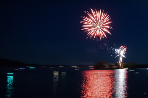
Canada Day fireworks off of Cow Island in Big Rideau Lake
Start Time: 2012-07-01 11:48 AM
End Time: 2012-07-03 1:20 PM
Active track info:
Distance: 33.9 NM
Total time: 49h 27'
Average Speed: 0.7 kts
Max Speed: 7.8 kts
Has been a beautiful start to our 2012 vacation cruise. 3 days in, and we will hit Kingston Ontario tomorrow afternoon. Current plans are to go down the St. Lawrence, head south on Lake Champlain, up the Erie canal, then cross Lake Ontario to home. Pictures and video to follow.
Click on the link to see our track in Google Maps.
Opinicon Lake Anchorage
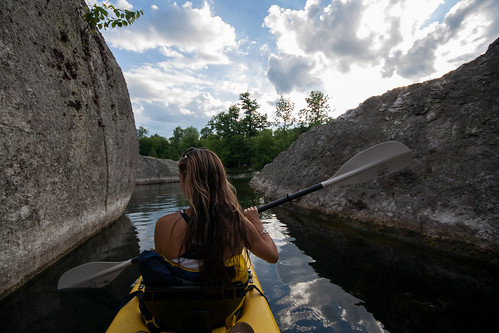
Morton Bay Kayaking. Cave!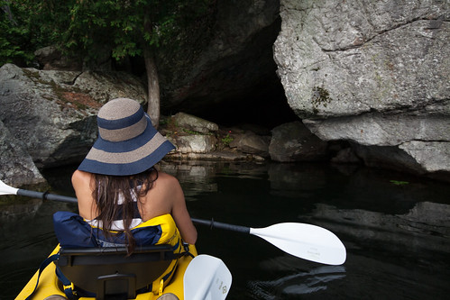
From inside the Cave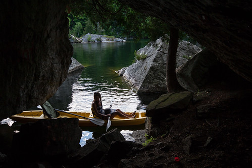
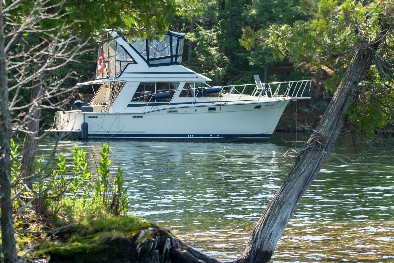
A beautiful 52 Krogen Express anchored in Morton Bay. Cyndi says that's the boat she want to have as a liveaboard. :)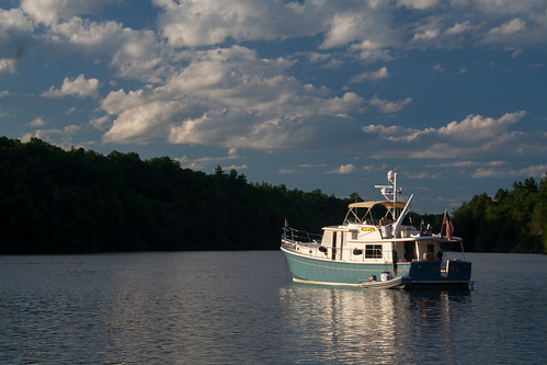
The C-Shel and the Krogen Express (Jackets II)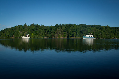
Start Time: 2012-07-01 11:48 AM
End Time: 2012-07-03 1:20 PM
Active track info:
Distance: 33.9 NM
Total time: 49h 27'
Average Speed: 0.7 kts
Max Speed: 7.8 kts
Has been a beautiful start to our 2012 vacation cruise. 3 days in, and we will hit Kingston Ontario tomorrow afternoon. Current plans are to go down the St. Lawrence, head south on Lake Champlain, up the Erie canal, then cross Lake Ontario to home. Pictures and video to follow.
Click on the link to see our track in Google Maps.
Opinicon Lake Anchorage
Morton Bay Kayaking. Cave!
From inside the Cave
A beautiful 52 Krogen Express anchored in Morton Bay. Cyndi says that's the boat she want to have as a liveaboard. :)
The C-Shel and the Krogen Express (Jackets II)
Subscribe to:
Posts (Atom)